


stgervais les Contamines voie romaine 12km

coglais
User
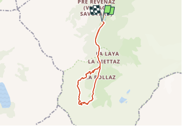

Length
11.9 km

Max alt
1951 m

Uphill gradient
771 m
Km-Effort
22 km

Min alt
1199 m

Downhill gradient
771 m
Boucle
Yes
Creation date :
2022-05-09 10:02:50.682
Updated on :
2022-05-28 15:40:35.811
4h00
Difficulty : Difficult

FREE GPS app for hiking
 SityTrail
IGN / Geographical institutes
SityTrail Plus
The world is yours!
About
Trail Nordic walking of 11.9 km to be discovered at Auvergne-Rhône-Alpes, Upper Savoy, Les Contamines-Montjoie. This trail is proposed by coglais.
Positioning
Country:
France
Region :
Auvergne-Rhône-Alpes
Department/Province :
Upper Savoy
Municipality :
Les Contamines-Montjoie
Location:
Unknown
Start:(Dec)
Start:(UTM)
322595 ; 5073787 (32T) N.
Comments